| Type: | Reconstruction |
| Client: | WisDOT Southwest Region |
| KL’s Role: | Prime Consultant |
| Location: | Waukesha County, Wisconsin |
| Limits: | Blue Ribbon Drive to Thackeray Trail |
| Length: | 2.5 miles |
| Design Complete: | August 2014 |
| Construction Complete: | Fall 2016 |
| Construction Cost: | $26 Million |
Engineering Elements
- Compressed Project Delivery Schedule
- Plans, Specifications & Estimate
- Traffic Analysis
- Public Involvement
- Utility Coordination
- Drainage Analysis
- Agency Coordination
- Environmental Assessment / FONSI
- Intersection Control Evaluation Reports
- Encroachment Report
- TRANS 75 Documentation
- Traffic Control Staging Plans
- Transportation Management Plan
- Bike & Pedestrian Accommodations
CTH PD Corridor Improvements
This project redesigned an existing 2-lane rural section to a 4-lane urban roadway with median, multi-modal accommodations, and improved intersection geometrics to address safety concerns. [add a sentence outlining the safely concerns?]
Sidewalks, a multi-use path, and bike lanes were incorporated throughout the corridor to make it usable for everyone. Curbed median with increased lighting and clearly marked crosswalks allow pedestrians to safely cross the 4-lane road at five intersections throughout the length of the project.
A traffic study revealed the need to signalize the intersection at CTH PD and Muir Field Road. [say more about pedestrian cross walk signals, etc.] Not only does the developed median provide a safe refuge for pedestrians, it also houses designated turn lanes to keep through traffic moving and a protected area for vehicles waiting to turn. An additional turn lane was also added to Maple Grove Drive to increase traffic access to CTH PD, which is heavily traveled by many of the 100,000+ employees of Epic Software.
New Pedestrian Bridge
Perhaps the most interesting aspect of this project is a beautiful multi-use path bridge structure that was constructed over CTH PD. The bridge allows for direct access to the Ice Age Junction Path (Dane County Parks) and Ice Age National Scenic Trail (National Park Service and Ice Age Trail Alliance). Both of these trails are located within the environmentally sensitive Multiple collaboration meetings were held with these agencies to sculpt the new design for this environmentally sensitive Ice Age Trail Junction Natural Resource Area owned by Dane County Parks. The developed bike and pedestrian paths offer access to this historic area while preserving XXX. Say something about the slope and grading and other considerations in path development.
One of the safety problems with the corridor was the slope of the hill near the CTH PD and High Point Road intersection. upgrading the roadway profile to reduce substandard slopes and to provide adequate vertical clearance for the proposed pedestrian bridge structure over CTH PD.
The crest of the roadway was lowered approximately 12-ft which resulted in significant utility impacts.To address this issue, the hill was shaved down by 12 feet, in order to rebuild a road that offered better visibility. The bottom of the new bridge is essentially at the level where the old road used to be. In order to construct this engineering feet, the project was built one side at a time. The west bound lanes were blasted and lowered first, with reinforces metal barriers in place to support the existing east bound lanes. Then the process was repeated for the other side. The bridge was designed by XXX [do we want to go there?] to accommodate 6 lanes of traffic, should the road need to be widened further in the future. The bridge utilizes the same decorative designs as the other multi-use path bridges throughout the City of Madison.
Utility Coordination
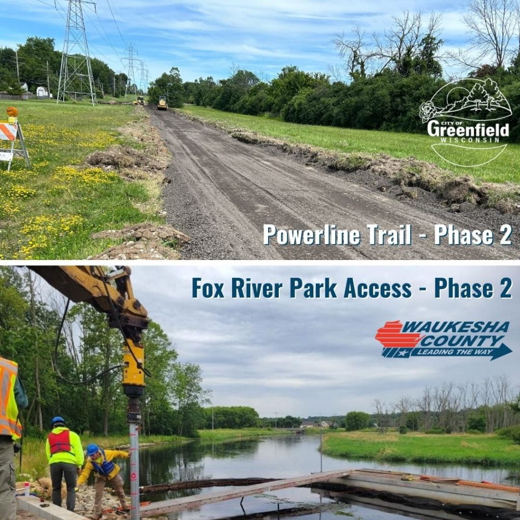
A critical aspect of the project was proactive utility coordination to determine existing utility facility impacts to provide sufficient lead time to develop a relocation plan for overhead high voltage electric transmission pole facilities as well as a high-pressure gas transmission line. As a result, both facilities were provided sufficient time to develop relocation plans, acquire easements, and perform relocations prior to construction.
Stormwater Improvements
Due to the additional travel lanes and increases in impervious area, the existing wet channel along the Badger Mill Creek was enhanced as part of the project. The existing Badger Mill Creek box culvert under CTH PD was extended and the channel both realigned and improved to function as a storm water treatment pond. Therefore, the pond can more efficiently remove total suspended solids (what is this?) and increase control peak discharge flows. This becomes important when…???