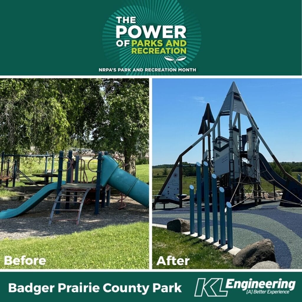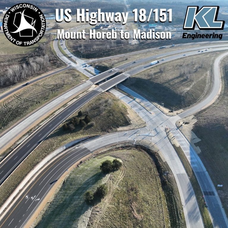
Our transportation engineering team often shows their true talents by consistently navigating complex design and construction tasks. Recently, the team improved 13.5 miles of USH 18/151, which was designed to stay within an existing right-of-way. This required creative solutions from our team. Traffic control for this stretch of highway was also made more complex by the heavy commuter traffic between the City of Verona and the City of Madison. With this in mind, our design team proactively widened pavement in order to accommodate the longer-term work zones and partial pavement replacement. KL Project Manager Dan Ryan said about the project, “This project started as a spot pavement repair / replacement project and grew into a significant safety enhancement project.” When asked what he enjoyed most about it, Dan said, “It’s great to work on a project you can almost see from your office window and know the benefits it will have for the traveling public.”
Dan had a protégé with this project in Nathan Rullman. At the beginning of the project, Nathan was just starting his career. “This project was my first deep dive into designing and making sheets for erosion control as well. I remember Dan supporting me by giving me some resources, but he gave me space to try things out for myself and give it a shot. I put the erosion control design together for the length of the project. It was an immense task since the project was so long, but after a bit of time, I got it down and was able to produce the necessary sheets for the plan.” Not only did Nathan learn more about erosion control, but he also got to work with software that was new to him throughout the project. “This project was also the maiden voyage of my journey with the Q2P MQ software. That had its own unique challenges, and I remember long late nights.” Nathan said.
KL’s design team worked closely with WisDOT pavement engineers to locate areas of concrete pavement repair and replacement using WisDOT provided 2-cm resolution aerials, delivering an accurate estimate from start to finish.